The highest point of the Sinclair Hollow Trail meets the Shenandoah Mountain Trail at a point that is (each way):
- 4.3 trail miles from FS 95 to the north via the Shenandoah Mountain Trail.
- 4.8 miles from Camp Todd and FS 95 to the east via the Wild Oak Trail, the Hiner Springs Trail, the Ramsey's Draft Trail, and the Shenandoah Mountain Trail.
- 7.0 miles from the Confederate Breastworks on U.S. 250 to the south via the Shenandoah Mountain Trail.
 |
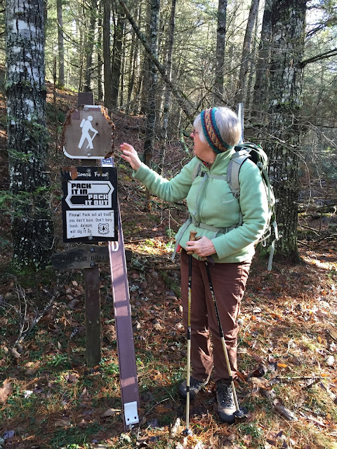
| Lynn checks out apparent bear hair in the lower right portion of the chewed up hiker sign. |
 |
| Can you see the hair hanging down from the sign at the 5:00 position? |
Although FS 95 was in great shape, the FS 64 portion involved some rough driving and a stream ford. I would not attempt this drive without a high clearance 4x4, and was glad that others could shuttle me to the trailhead! I would not even do it with my Subaru Outback unless this part of Virginia had been experiencing an extended dry period. FS 64 is gated near where we parked our vehicle, though the gate did not have a lock, so we continued past that point.
And, although some guidebooks state that FS 64 links to the south with US 250 in the town of Head Waters, I do not believe this is true. So there are no shortcuts to this remote trailhead.
Sinclair Hollow Trail starts out on level ground at about 2600 feet elevation, crossing Shaws Fork of the Cowpasture River soon after passing the sign for the trail on FR 64. Shaws Fork and its feeder stream in Sinclair Hollow are the northernmost streams in the James River system. The stream just to the north (Brushy Fork) flows north into West Virginia before becoming part of the South Fork, Potomac River and reaching the Chesapeake via Washington DC instead of Richmond.
The trail climbs Shenandoah Mountain's west side, going 1.6 miles up Sinclair Hollow. The trail is fairly steep for half of the length as it ascends the mountain, so be prepared to work hard.
The trail climbs Shenandoah Mountain's west side, going 1.6 miles up Sinclair Hollow. The trail is fairly steep for half of the length as it ascends the mountain, so be prepared to work hard.
 |
| Panorama from the Sinclair Hollow Trail, taken about half way up the mountain. |
 |
| Yellow plastic diamond signals the trail as it descends Shenandoah Mountain. |
 |
| Sign where the Sinclair Hollow Trail ends at the Shenandoah Mountain Trail. You can see a Wilderness Boundary sign above the trail sign, though most of that sign is gone. |
 |
| Having lunch at a large campsite on the Shenandoah Mountain Trail next to the Sinclair Hollow Trail's terminus. |
The Sinclair Hollow Trail itself would be part of the proposed Shenandoah National Scenic Area (NSA). NSAs have fewer use restrictions than Federal Wilderness Areas, so mountain bikes and hunters' game carts would be permitted on this trail. (An example of a local NSA is the summit of Cole Mountain, on the Appalachian Trail near Amherst and Buena Vista.) As a result of accommodations to various groups with sometimes disparate interests in the use of the National Forest, the Friends proposal has received endorsements from a large number of organizations (List). I recommend that you check out their website and review their proposals, and I strongly support their work.


No comments:
Post a Comment
Note: Only a member of this blog may post a comment.